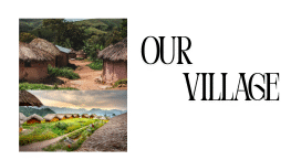

Here’s an image that evokes the rural ambiance of a village in Uttar Pradesh—while it may not be Bohadpura specifically, it offers a visual sense of the region’s rustic character.
Overview: Bohadpura Village, Jalaun District, Uttar Pradesh
Bohadpura is a village in Orai Tehsil, Jalaun district, situated approximately 7 km from the town of Orai, and lies about 211 km from the state capital, Lucknow (OneFiveNine).
Demographics
- Total population (2011): ~2,523, across 383 households (Census 2011 India).
- Gender breakdown: 1,331 males and 1,192 females.
- Sex ratio: 896 females per 1,000 males, below the Uttar Pradesh average (Census 2011 India).
- Child population (0–6 years): 342 children (about 14% of total population); child sex ratio is 943, higher than the all-age ratio (Census 2011 India).
Literacy
- Overall literacy rate: Around 65.11%, slightly above the Jalaun district average but below the national average (www.censusindia.co.in).
- Male literacy: Approximately 79.8%.
- Female literacy: Around 48.5%—indicating a significant gender gap in education (Census 2011 India).
Caste Composition & Employment
- Scheduled Caste (SC) population: Constitutes about 27.7% of residents; no Scheduled Tribe (ST) members recorded (Census 2011 India).
- Workforce: Out of total population, 892 individuals are engaged in work:
- Main workers (employed > 6 months): 664 (e.g., 260 cultivators, 200 agricultural laborers, 129 in household industries)
- Marginal workers (< 6 months): 228 (www.censusindia.co.in).
Infrastructure & Connectivity
- The village has a functioning Gram Panchayat and is headed by an elected Sarpanch (www.censusindia.co.in).
- Transport links: Public and private bus services are available within the village. The nearest railway station lies within 5–10 km (village database).
- Education infrastructure: Bohadpura hosts Government primary and middle schools. For higher secondary and professional education, residents rely on institutions in nearby towns like Orai, Kanpur, and Jhansi (OneFiveNine).
- Land use details: The village spans an area including 427.6 hectares, with 161.6 hectares of forest land, 259 hectares under irrigation, and 81.7 hectares in non-agricultural use (OneFiveNine).
Estimated Growth
- Based on trend projections, the population may reach about 3,000 by 2024 and 3,026 by 2025, implying modest growth at roughly 0.8% per year (Census of India).
Summary Table
| Attribute | Details |
|---|---|
| Location | Orai Tehsil, Jalaun District, UP |
| Population (2011) | ~2,523 |
| Literacy Rate | 65.11% overall (79.8% male, 48.5% female) |
| SC Population | ~27.7% |
| Main Employment | Agriculture, household industries |
| Infrastructure | Schools, bus service, near railway |
| Population Growth | Estimated ~3,000 by 2025 |